Art Institute of Chicago
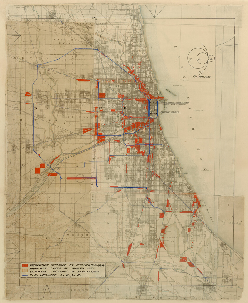
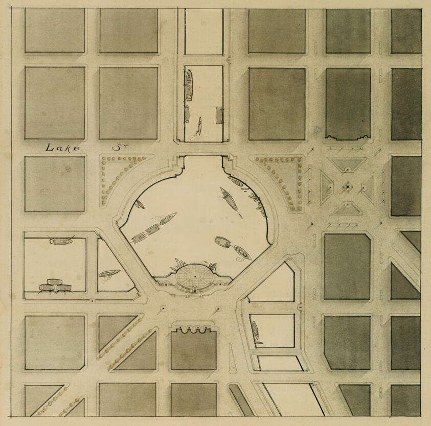
Plan of Chicago, Chicago, Illinois, Railroad Circuits Diagram
Daniel Hudson Burnham (American, 1846-1912)
- Date
- 1909
- Medium
- Colored ink and paint on a printed map
- Culture
- Chicago
- Department
- Architecture and Design
- Institution
- Art Institute of Chicago
The authoritative record is held by Art Institute of Chicago. LinkedCulture surfaces this object and its connections; it does not alter institutional metadata.
Linked open data
Authority identifiers that link this record into the wider web of cultural data — stable references you can follow to the source.
- Object type
- AAT300054197
Related across collections
Semantically similar works from Art Institute of Chicago and other institutions.
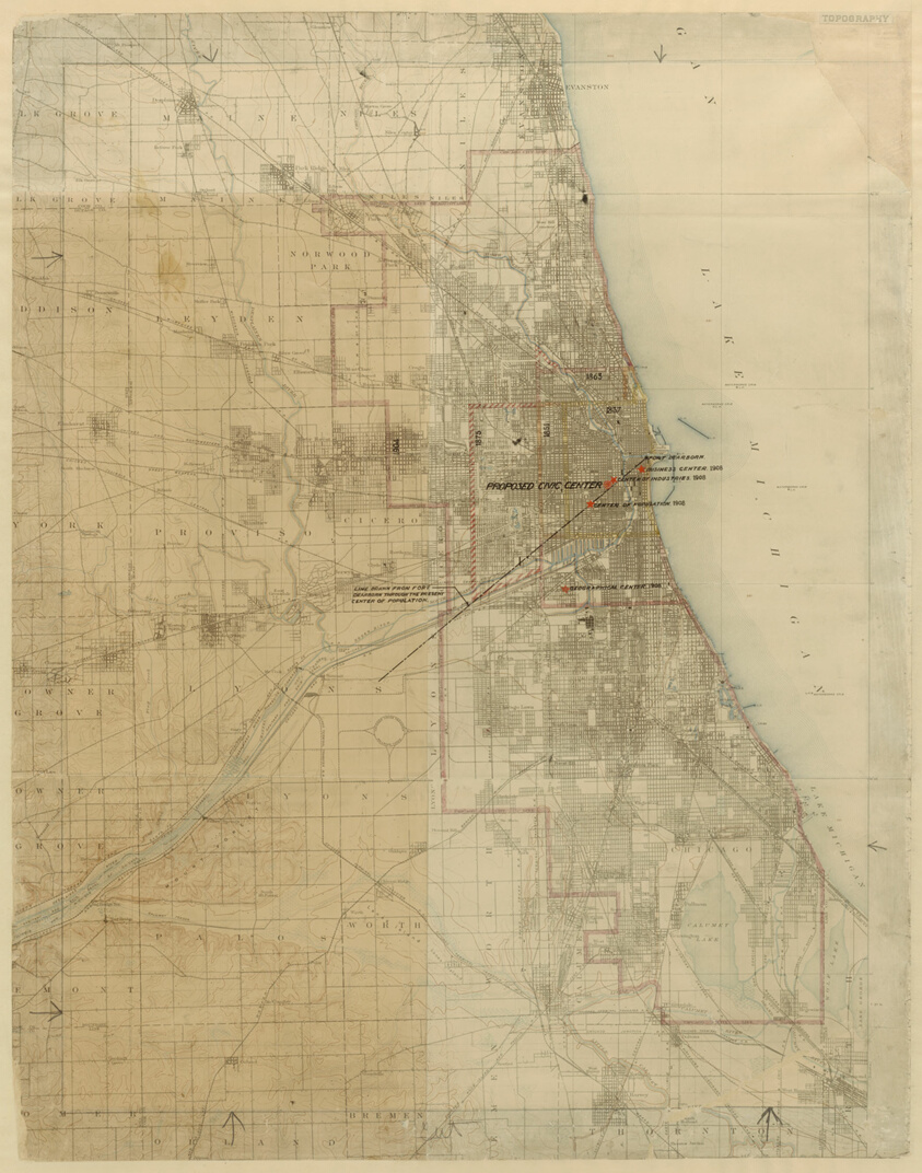
Plan of Chicago, Chicago, Illinois, Diagram Showing City Growth
Art Institute of Chicago
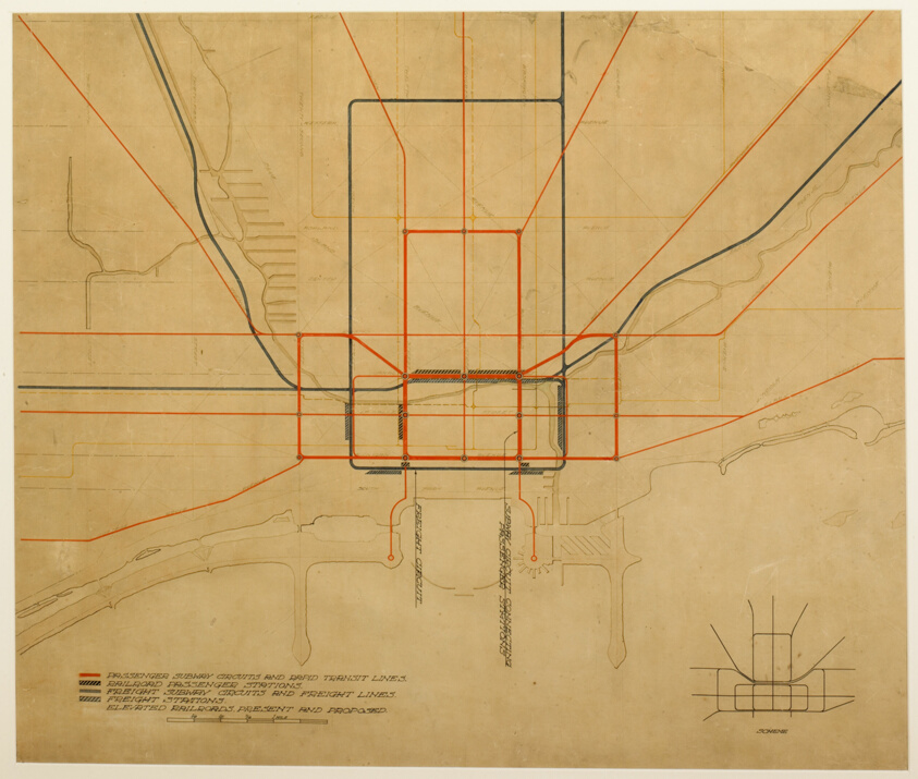
Plate 75 from The Plan of Chicago, 1909: Chicago. Diagram of the City, Showing Complete System of Inner Circuits
Art Institute of Chicago
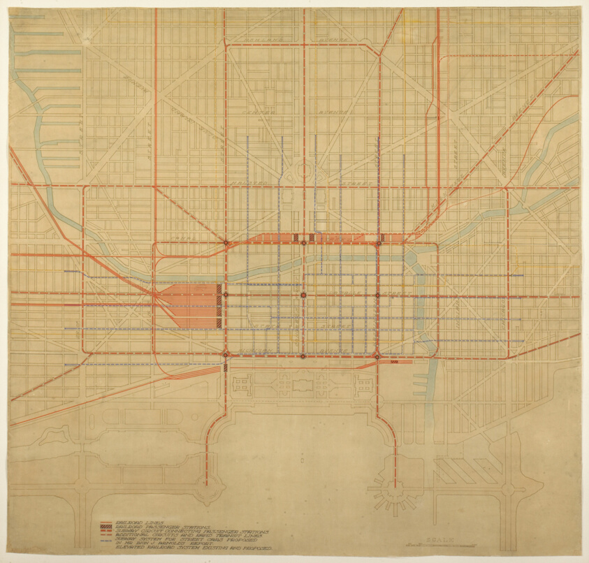
Plate 80 from The Plan of Chicago, 1909: Chicago. Diagram of City Center, Showing the Proposed Arrangement of Railroad Passenger Stations, the Complete Traction System, Including Rapid Transit, Subway, and Elevated Roads, and the Circuit Subway Line.
Art Institute of Chicago
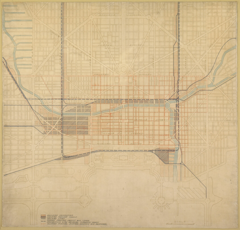
Plate 74 from The Plan of Chicago,1909: Chicago. Diagram of the City Center, Showing the General Location of Existing Freight Yards and Railroad Lines, the Present Tunnel System and Proposed Circuit, and Connections for all these Services, Running to the Central Clearing Yards.
Art Institute of Chicago
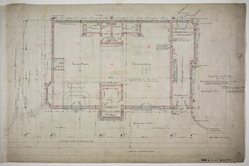
Oakland Avenue Railroad Station, Chicago, Illinois, First Floor Plan
Art Institute of Chicago
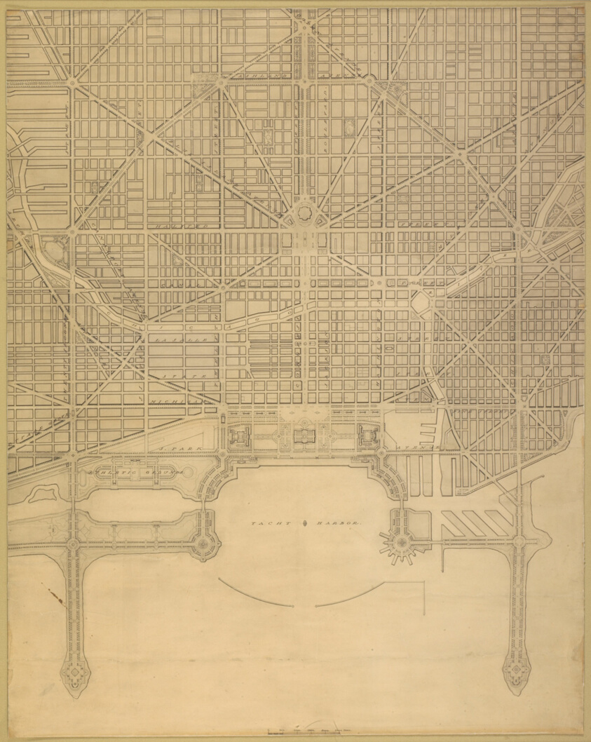
Plate 110 from The Plan of Chicago, 1909: Chicago. Plan of the Complete System of Street Circulation; Railway Stations; Parks, Boulevard Circuits and Radial Arteries; Public Recreation Piers, Yacht Harbor, and Pleasure-Boat Piers; Treatment of Grant Park; the Main Axis and the Civic Center, Presenting the City as a Complete Organism in which All its Functions are Related One to Another in such a Manner that it will Become a Unit
Art Institute of Chicago
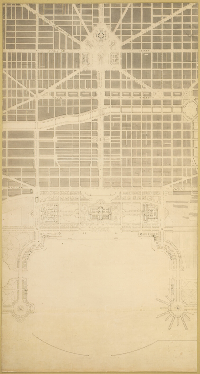
Plate 129 from The Plan of Chicago, 1909: Chicago. The Business Center of the City, Within the First Circuit Boulevard, Showing the Proposed Grand East-and-West Axis and Its Relation to Grant Park and the Yacht Harbor; the Railway Terminals Schemes on the South and West Sides, and the Civic Center
Art Institute of Chicago
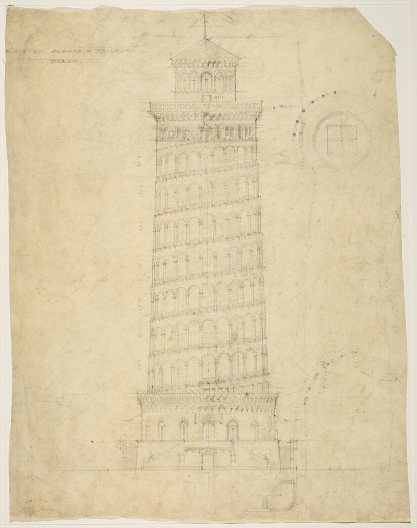
World's Columbian Exposition Elevated Electric Railroad Tower, Chicago, Illinois, Elevation
Art Institute of Chicago
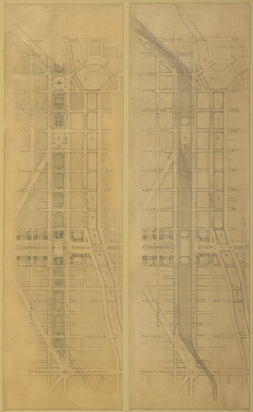
Plate 79 (2 Drawings) from The Plan of Chicago, 1909: Suggested Location and Arrangement of the Railway Passenger Stations West of the River. Overhead Scheme: 1. Plan at Street Level. 2. Plan Above Street Level
Art Institute of Chicago
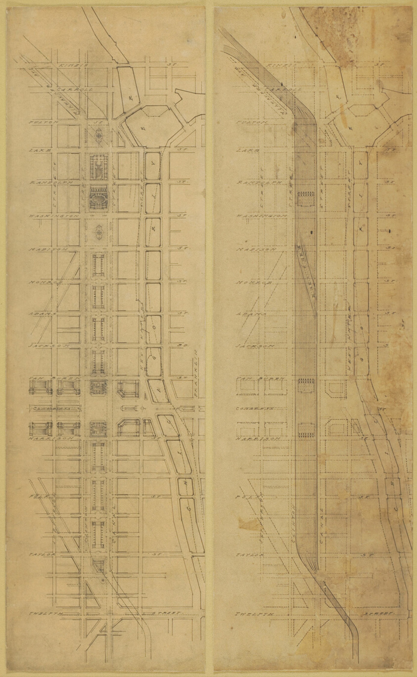
Plate 78 (2 Drawings) from The Plan of Chicago, 1909: Suggested Location and Arrangement of the Railway Passenger Stations West of the River. Subway Scheme: 1. Plan of Street Level. 2. Plan Below Street Level
Art Institute of Chicago
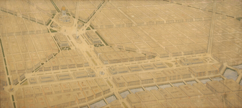
Plate 122 from The Plan of Chicago, 1909: Chicago. Railway Station Scheme West of the River Between Canal and Clinton Streets, Showing the Relation With the Civic Center.
Art Institute of Chicago
The Plan of Chicago Plate 106, Chicago, Illinois, Presentation Drawing
Art Institute of Chicago