Art Institute of Chicago
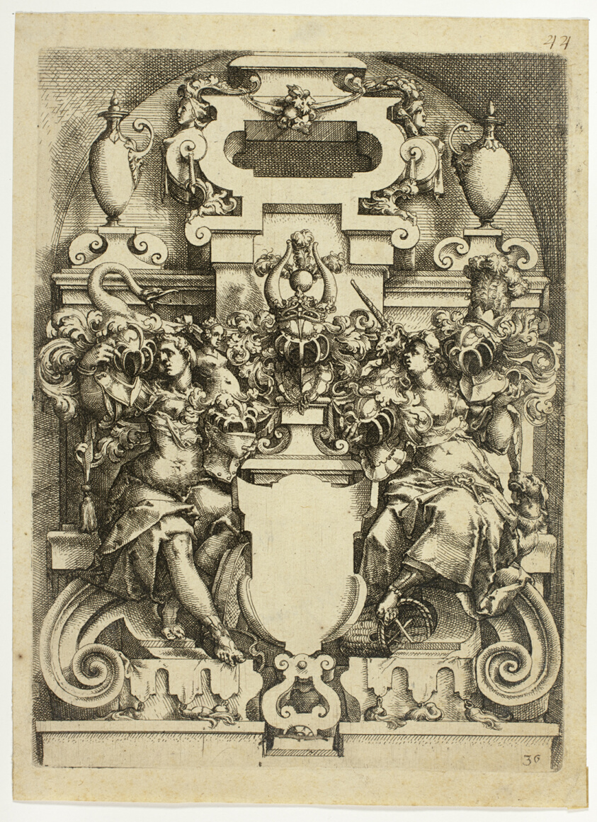
Fantastic Architecture, plate 36 (later 44, and 125) from Architectura
Wendel Dietterlin
- Date
- c. 1596
- Medium
- Etching in black ink on cream laid paper
- Culture
- Austria
- Department
- Prints and Drawings
- Institution
- Art Institute of Chicago
The authoritative record is held by Art Institute of Chicago. LinkedCulture surfaces this object and its connections; it does not alter institutional metadata.
Linked open data
Authority identifiers that link this record into the wider web of cultural data — stable references you can follow to the source.
- Object type
- AAT300041273
Related across collections
Semantically similar works from Art Institute of Chicago and other institutions.
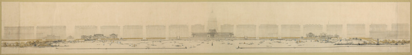
Plate 125 from The Plan of Chicago, 1909: Chicago. Elevation of Grant Park and Harbor; the Eastern Facade of the City on Michigan Avenue, and the Dome of the Administration Building of the Civic Center, Looking from Lake Michigan.
Art Institute of Chicago
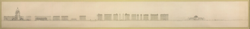
Plate 126 from The Plan of Chicago, 1909: Chicago. Section Looking North, Taken through Proposed Grand Axis of the City, Showing the Civic Center and Grant Park.
Art Institute of Chicago
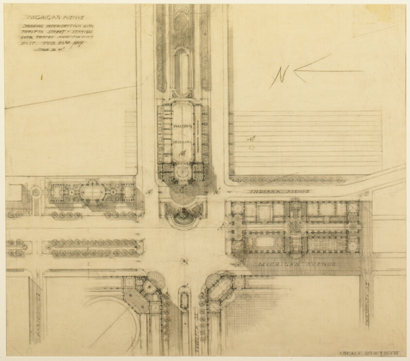
Plate 119 from The Plan of Chicago, 1909: Chicago. Sketch Plan of the Intersection of Michigan Avenue and Twelfth Street
Art Institute of Chicago

Plate 88 from Architectura
Minneapolis Institute of Art

Plate 12
Minneapolis Institute of Art
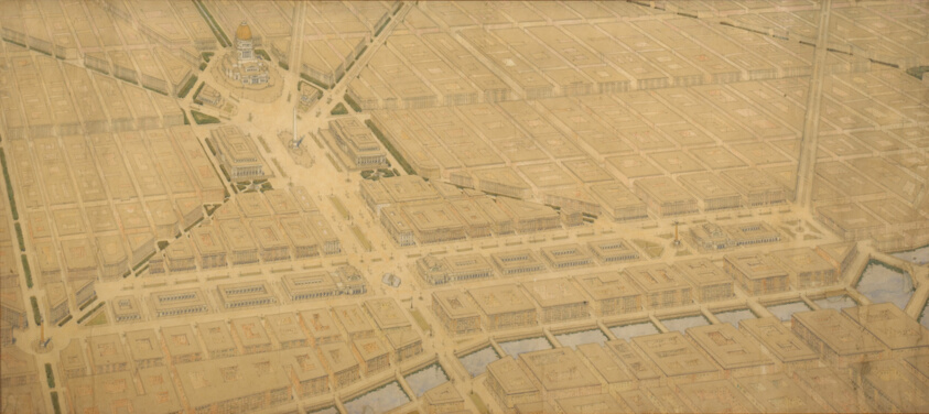
Plate 122 from The Plan of Chicago, 1909: Chicago. Railway Station Scheme West of the River Between Canal and Clinton Streets, Showing the Relation With the Civic Center.
Art Institute of Chicago
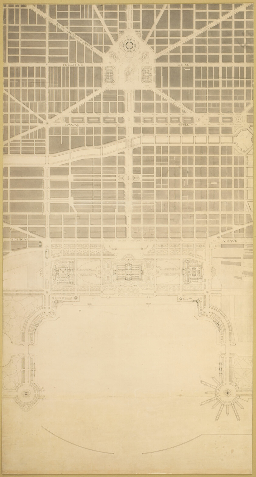
Plate 129 from The Plan of Chicago, 1909: Chicago. The Business Center of the City, Within the First Circuit Boulevard, Showing the Proposed Grand East-and-West Axis and Its Relation to Grant Park and the Yacht Harbor; the Railway Terminals Schemes on the South and West Sides, and the Civic Center
Art Institute of Chicago

Plate No. 36, from Costume Francais
Minneapolis Institute of Art

Plate 14 (Act V, Scene II), from Othello: Quinze equisses a l'eau forte
Minneapolis Institute of Art
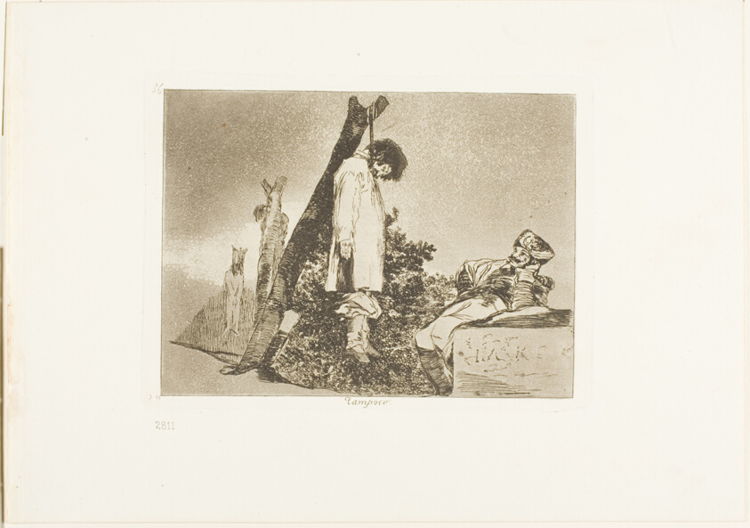
Not in this case, plate 36 from The Disasters of War
Art Institute of Chicago

Plate 35 from Plan of Chicago 1909: Chicago, and Diagram of Lake Michigan. Proposed Roadway to connect all the towns along the shores of the Lake.
Art Institute of Chicago

Plate 12
Minneapolis Institute of Art