Art Institute of Chicago
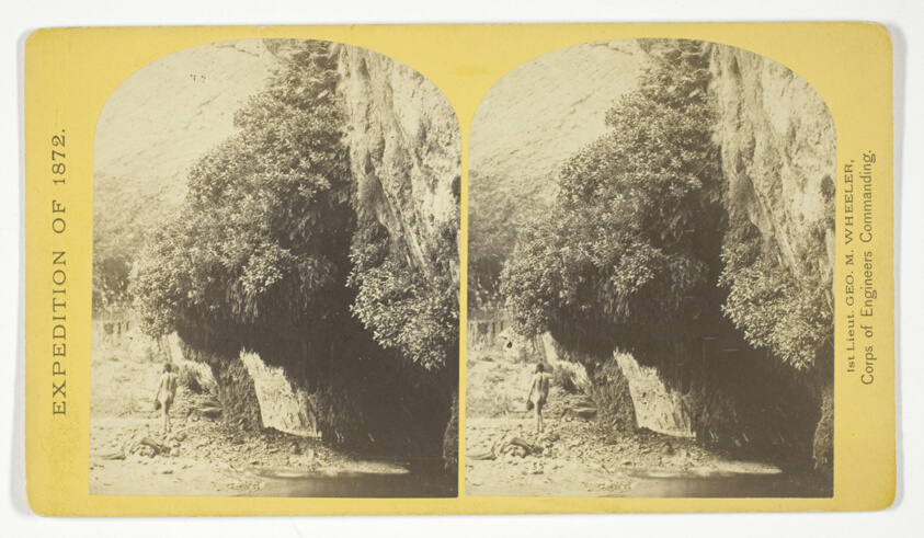
"The Bath," a dripping spring in Kanab Cañon. Temperature, 69° Fahr, No. 9 from the series "Geographical Explorations and Surveys West of the 100th Meridian"
William H. Bell (American, 1830-1910)
- Date
- 1872
- Medium
- Albumen print, stereo
- Culture
- United States
- Department
- Photography and Media
- Institution
- Art Institute of Chicago
The authoritative record is held by Art Institute of Chicago. LinkedCulture surfaces this object and its connections; it does not alter institutional metadata.
Linked open data
Authority identifiers that link this record into the wider web of cultural data — stable references you can follow to the source.
- Object type
- AAT300046300
Related across collections
Semantically similar works from Art Institute of Chicago and other institutions.
!["The Bath," a dripping spring in Kanab Canon. Temperature, 69 [degrees] Fahr.](https://media.getty.edu/iiif/image/f9b35851-eb2e-4363-9cef-8447e37f8afa/full/808,/0/default.jpg)
"The Bath," a dripping spring in Kanab Canon. Temperature, 69 [degrees] Fahr.
Getty Museum
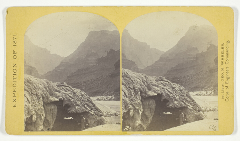
The Cañon of Kanab Creek, near its junction with the Grand Cañon of the Colorado. In the foreground is a dripping spring affording a shower bath. Temperature, 69° Fahr, No. 8 from the series "Geographical Explorations and Surveys West of the 100th Meridian"
Art Institute of Chicago
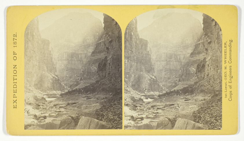
The mouth of Kanab Creek. The beds of the Colorado River and its tributary here lie in gorges cut by the running water to the depth of about 3.500 feet below the general surgace of the country. The highest point seen in the picture is 2.500 feet above the water, and the walls are here too steep to be scaled, No. 10 from the series "Geographical Explorations and Surveys West of the 100th Meridian"
Art Institute of Chicago
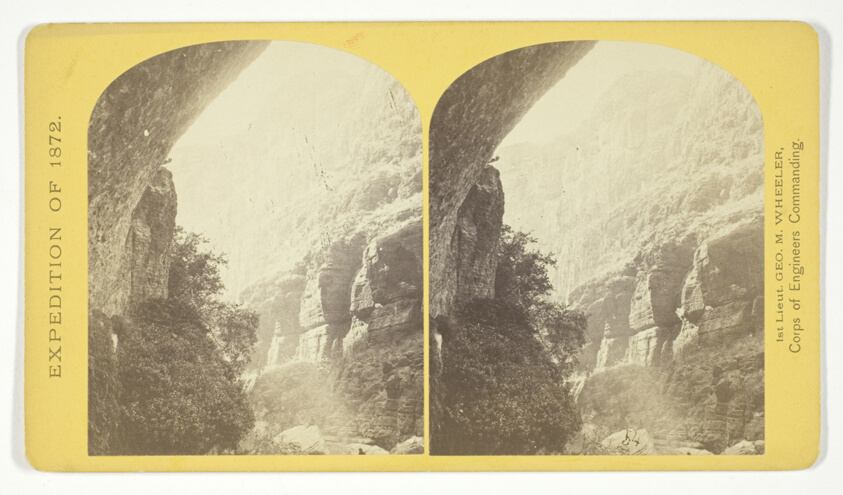
Grotto Spring, Grand Cañon, Colorado River, No. 4 from the series "Explorations and Surveys West of the 100th Meridian"
Art Institute of Chicago

The Bath, Kanab Wash.
Getty Museum

The mouth of Kanab Creek. The beds of the Colorado River and its tributary here lie in gorges cut by the running water...
Getty Museum

The mouth of Kanab Creek. The beds of the Colorado River and its tributary here lie in gorges cut by the running water...
Getty Museum
![[Water running from the rock at "Hot Springs" - temperature 120., Santa Barbara, California]](https://media.getty.edu/iiif/image/95711a1a-a445-4ee2-a93c-5f5c367b2227/full/808,/0/default.jpg)
[Water running from the rock at "Hot Springs" - temperature 120., Santa Barbara, California]
Getty Museum
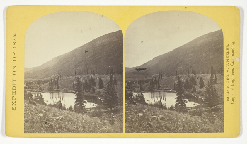
Beaver Lake, Conejos Cañon, Colorado, 9.000 feet above sea-level, and 30 miles from mouth of Cañon, No. 35 from the series "Geographical Explorations and Surveys West of the 100th Meridian"
Art Institute of Chicago
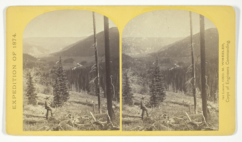
Cañon, Valley of the Conejos River, looking south from vicinity of "Lost Lakes", No. 36 from the series "Geographical Explorations and Surveys West of the 100th Meridian"
Art Institute of Chicago
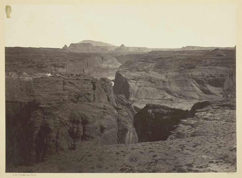
Cañon of the Colorado River, near Mouth of San Juan River, Arizona
Art Institute of Chicago
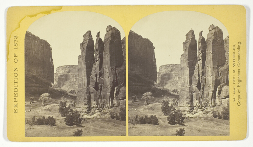
Camp Beauty, Canñon de Chelle; walls 1.200 feet high, width of Cañon at this point about one fourth of a mile. This view shows the perpendicular effect wrought by the action of floods. The Artist of the Expedition, Mr. Wyant, of New York, made a study of this scene with the intention to paint it as a characteristic Canon view, No. 25 from the series "Geographical Explorations and Surveys West of the 100th Meridian"
Art Institute of Chicago