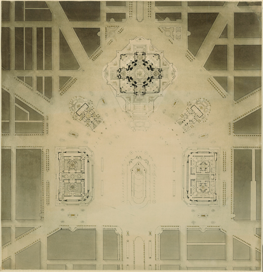
Art Institute of Chicago
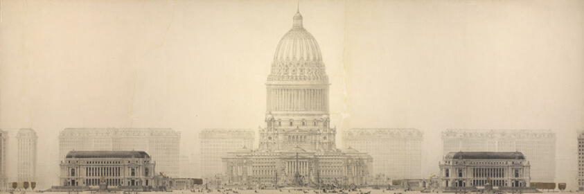
Plate 131 from The Plan of Chicago, 1909: Chicago. Elevation Showing the Group of Buildings Constituting the Proposed Civic Center.
Daniel Hudson Burnham, American, 1846-1912
- Date
- 1909
- Medium
- Ink on paper
- Culture
- Chicago
- Department
- Architecture and Design
- Institution
- Art Institute of Chicago
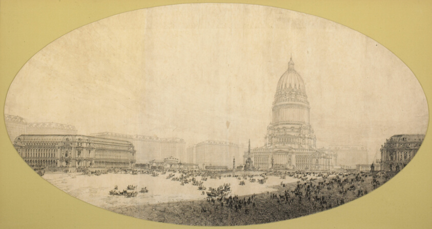
Although only portions were put into effect, the 1909 Plan of Chicago remains one of the largest and most compre- hensive proposals for the transformation of an American city. One central aspect of the plan was a large civic center intended for an area just west of the Chicago River. Modeled on the monuments and boulevards of 19th-century Paris and Daniel Burnham’s Court of Honor at the 1893 World’s Columbian Exposition, the complex features a tall domed building, reflecting pool, and large public square. Ultimately unrealized, Burnham’s plan imagined the Civic Center as secular temple that would serve to unify the citizens of this growing modern metropolis at a time of labor strikes and civic unrest around the country.
The authoritative record is held by Art Institute of Chicago. LinkedCulture surfaces this object and its connections; it does not alter institutional metadata.
Linked open data
Authority identifiers that link this record into the wider web of cultural data — stable references you can follow to the source.
- Object type
- AAT300054197
Related across collections
Semantically similar works from Art Institute of Chicago and other institutions.
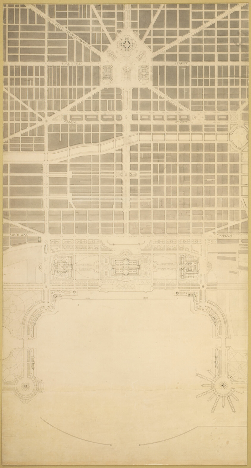
Plate 129 from The Plan of Chicago, 1909: Chicago. The Business Center of the City, Within the First Circuit Boulevard, Showing the Proposed Grand East-and-West Axis and Its Relation to Grant Park and the Yacht Harbor; the Railway Terminals Schemes on the South and West Sides, and the Civic Center
Art Institute of Chicago
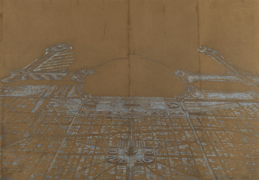
Plate 137 from The Plan of Chicago, 1909: Chicago. View of the Proposed Development in the Center of the City, from Twenty-Second Street to Chicago Avenue, Looking Towards the East Over the Civic Center to Grant Park and Lake Michigan
Art Institute of Chicago
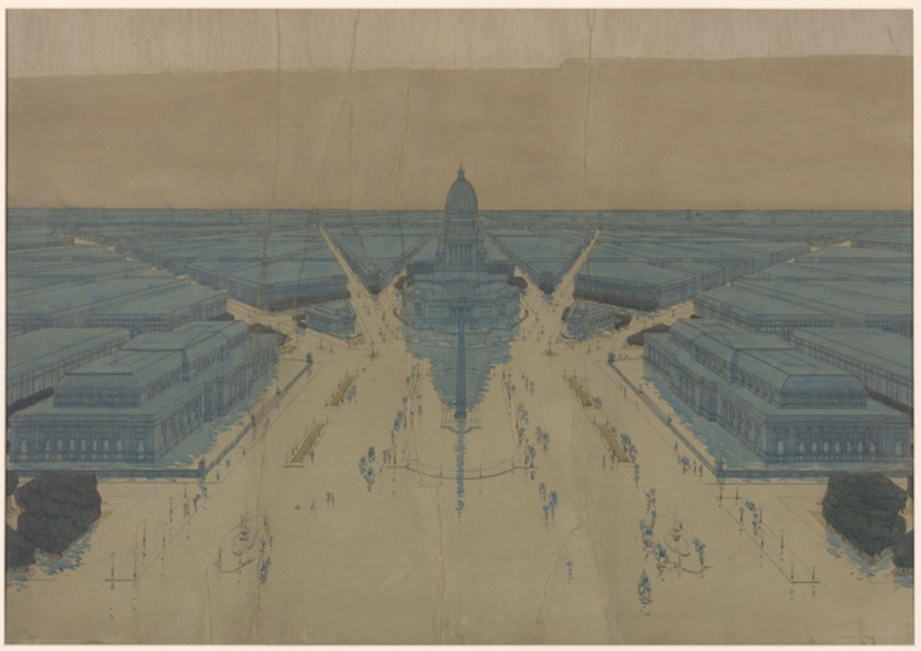
View of the Proposed Civic Center Plaza and Buildings, The 1909 Plan of Chicago
Art Institute of Chicago
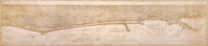
Plate 49 from Plan of Chicago 1909: Chicago. View of the City from Jackson Park to Grant Park, Looking Towards the West. The proposed shore treatment as a park enclosing a waterway (or a series of lagoons) is shown, together with the enlarged yacht harbor, recreation piers, and a scheme for Grant Park.
Art Institute of Chicago
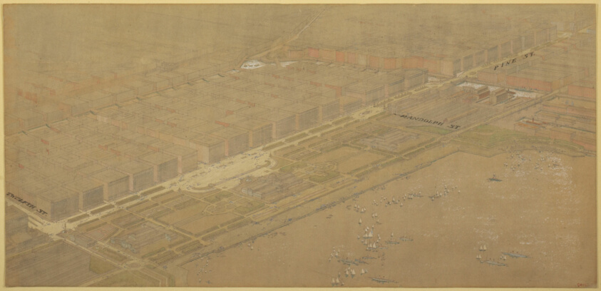
Plate 114 from The Plan of Chicago, 1909: Chicago. Proposed Boulevard and Parkway on Michigan Avenue and Pine Street
Art Institute of Chicago
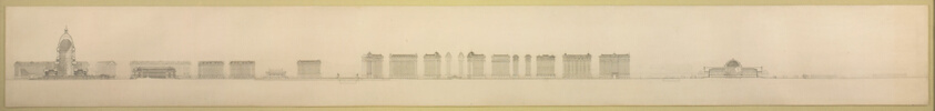
Plate 126 from The Plan of Chicago, 1909: Chicago. Section Looking North, Taken through Proposed Grand Axis of the City, Showing the Civic Center and Grant Park.
Art Institute of Chicago
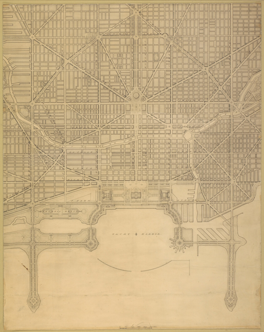
Plate 110 from The Plan of Chicago, 1909: Chicago. Plan of the Complete System of Street Circulation; Railway Stations; Parks, Boulevard Circuits and Radial Arteries; Public Recreation Piers, Yacht Harbor, and Pleasure-Boat Piers; Treatment of Grant Park; the Main Axis and the Civic Center, Presenting the City as a Complete Organism in which All its Functions are Related One to Another in such a Manner that it will Become a Unit
Art Institute of Chicago
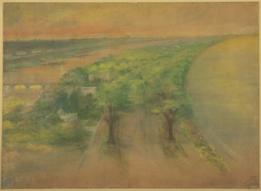
Plate 50 A from Plan of Chicago 1909: Chicago. View of the Proposed Park on the South Shore Looking Northwest Towards the City.
Art Institute of Chicago
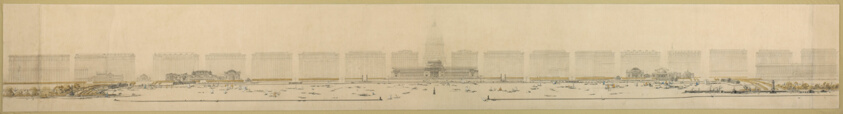
Plate 125 from The Plan of Chicago, 1909: Chicago. Elevation of Grant Park and Harbor; the Eastern Facade of the City on Michigan Avenue, and the Dome of the Administration Building of the Civic Center, Looking from Lake Michigan.
Art Institute of Chicago
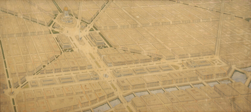
Plate 122 from The Plan of Chicago, 1909: Chicago. Railway Station Scheme West of the River Between Canal and Clinton Streets, Showing the Relation With the Civic Center.
Art Institute of Chicago
Proposed Civic Center Square, Plan of Chicago
Art Institute of Chicago
Civic Center, Plan of Chicago, Chicago, Illinois, Site Plan
Art Institute of Chicago