Art Institute of Chicago
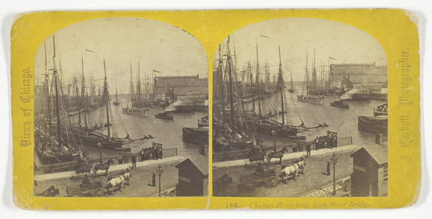
Chicago River from Rush Street Bridge, No. 188 from the series "Views of Chicago"
J. Carbutt
- Date
- Late 19th century
- Medium
- Albumen print, stereo
- Culture
- Chicago
- Department
- Photography and Media
- Institution
- Art Institute of Chicago
The authoritative record is held by Art Institute of Chicago. LinkedCulture surfaces this object and its connections; it does not alter institutional metadata.
Linked open data
Authority identifiers that link this record into the wider web of cultural data — stable references you can follow to the source.
- Object type
- AAT300046300
Related across collections
Semantically similar works from Art Institute of Chicago and other institutions.

Chicago River from Rush Street Bridge.
Getty Museum
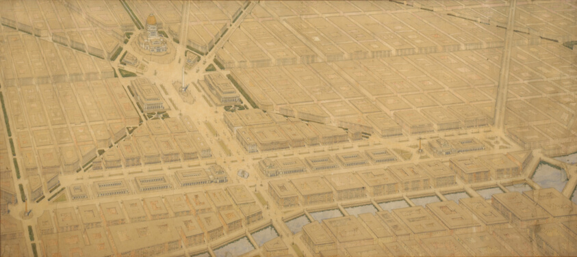
Plate 122 from The Plan of Chicago, 1909: Chicago. Railway Station Scheme West of the River Between Canal and Clinton Streets, Showing the Relation With the Civic Center.
Art Institute of Chicago
![[Rush Street Bridge looking north, Chicago, Illinois]](https://media.getty.edu/iiif/image/5e8e4755-2550-4ad1-92c0-450f1dd6e9f2/full/808,/0/default.jpg)
[Rush Street Bridge looking north, Chicago, Illinois]
Getty Museum

Chicago River and Train
Getty Museum
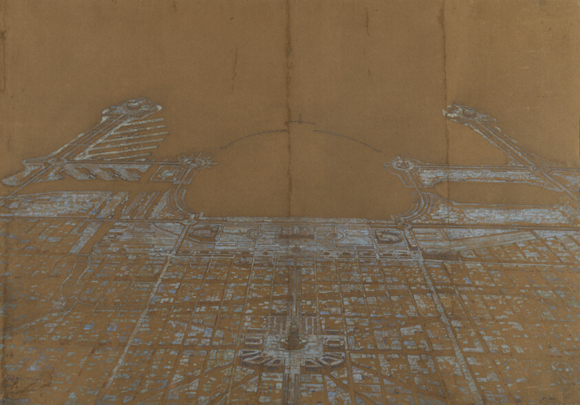
Plate 137 from The Plan of Chicago, 1909: Chicago. View of the Proposed Development in the Center of the City, from Twenty-Second Street to Chicago Avenue, Looking Towards the East Over the Civic Center to Grant Park and Lake Michigan
Art Institute of Chicago
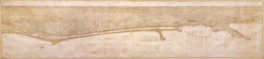
Plate 49 from Plan of Chicago 1909: Chicago. View of the City from Jackson Park to Grant Park, Looking Towards the West. The proposed shore treatment as a park enclosing a waterway (or a series of lagoons) is shown, together with the enlarged yacht harbor, recreation piers, and a scheme for Grant Park.
Art Institute of Chicago
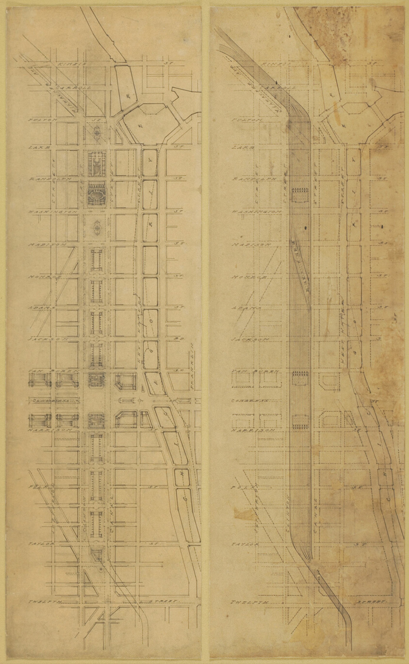
Plate 78 (2 Drawings) from The Plan of Chicago, 1909: Suggested Location and Arrangement of the Railway Passenger Stations West of the River. Subway Scheme: 1. Plan of Street Level. 2. Plan Below Street Level
Art Institute of Chicago

Views on Chicago River.
Getty Museum
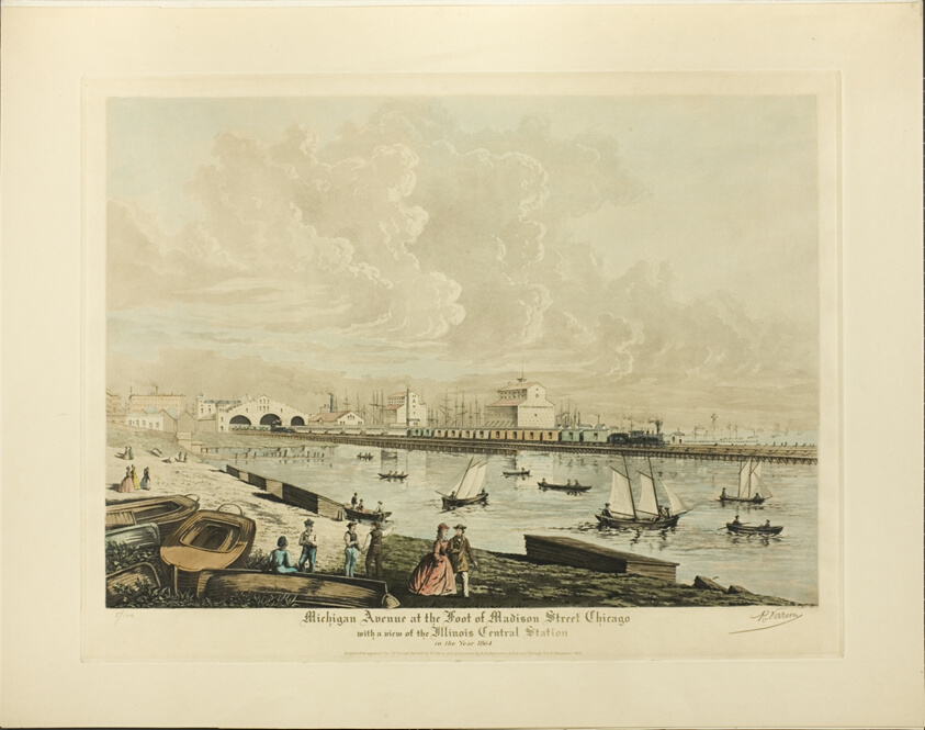
Michigan Avenue at the Foot of Madison Street, Chicago, with a view of the Illinois Central Station in the Year 1864
Art Institute of Chicago
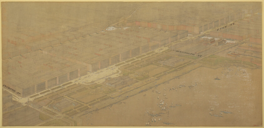
Plate 114 from The Plan of Chicago, 1909: Chicago. Proposed Boulevard and Parkway on Michigan Avenue and Pine Street
Art Institute of Chicago
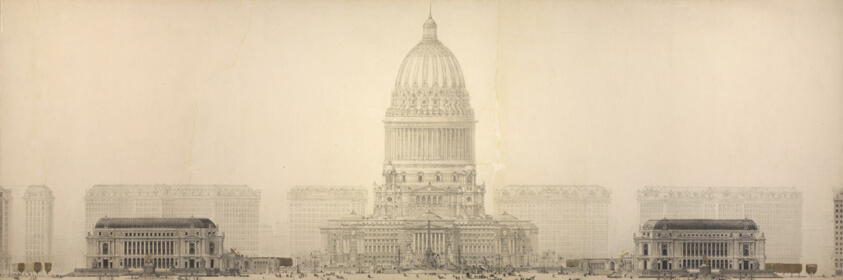
Plate 131 from The Plan of Chicago, 1909: Chicago. Elevation Showing the Group of Buildings Constituting the Proposed Civic Center.
Art Institute of Chicago
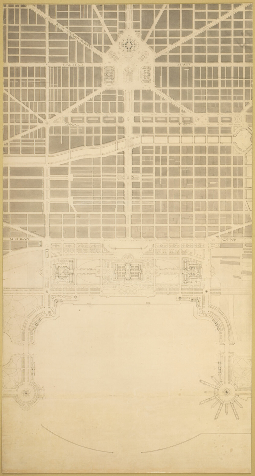
Plate 129 from The Plan of Chicago, 1909: Chicago. The Business Center of the City, Within the First Circuit Boulevard, Showing the Proposed Grand East-and-West Axis and Its Relation to Grant Park and the Yacht Harbor; the Railway Terminals Schemes on the South and West Sides, and the Civic Center
Art Institute of Chicago