Art Institute of Chicago
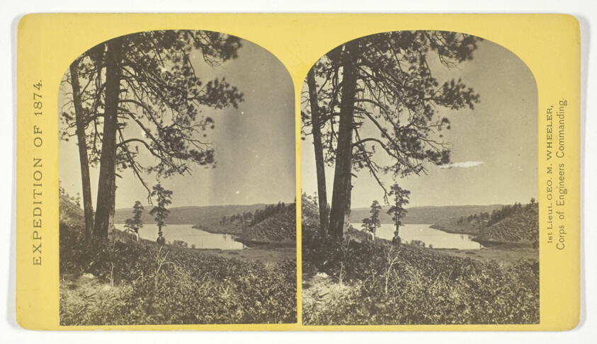
Lagunas Caballo, or Horse Lakes, 14 miles, N. W. from Tierra Amarilla, New Mexico. The water of the lakes is strongly mineral and not fit for men or animals to drink, No. 44 from the series "Geographical Explorations and Surveys West of the 100th Meridian"
Timothy O'Sullivan (American, born Ireland, 1840–1882)
- Date
- 1874
- Medium
- Albumen print, stereo
- Culture
- United States
- Department
- Photography and Media
- Institution
- Art Institute of Chicago
The authoritative record is held by Art Institute of Chicago. LinkedCulture surfaces this object and its connections; it does not alter institutional metadata.
Linked open data
Authority identifiers that link this record into the wider web of cultural data — stable references you can follow to the source.
- Object type
- AAT300046300
Related across collections
Semantically similar works from Art Institute of Chicago and other institutions.

Lagunas Caballo, or Horse Lakes, 14 miles, N.W. from Tierra Amarilla, New Mexico. The waters of the lakes is strongly mineral...
Getty Museum

Pueblo Laguna, New Mexico
Getty Museum
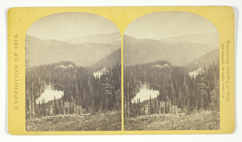
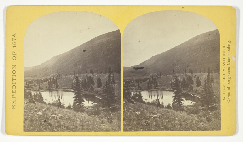
Lost Lakes, head of Conejos Cañon, Colorado, in the Sierra San Juan range, near divide between Conejos and south fork of Alamosa Rivers, surrounded by forest of Douglass spruce, and approximately 11.000 feel above sea-level, No. 37 from the series "Geographical Explorations and Surveys West of the 100th Meridian"
Art Institute of Chicago
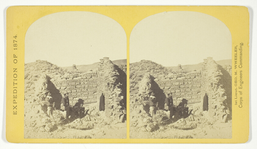
Characteristic ruin, of the Pueblo San Juan, New Mexico, on the north bank of the San Juan River, about 15 miles west of the mouth of Cañon Largo. The present race of Indians know nothing of when or by whom these buildings were constructed. The ruin is about 350 feet square, and built of natural stone, joined together by a mud cement, No. 43 from the series "Geographical Explorations and Surveys West of the 100th Meridian"
Art Institute of Chicago

Headwaters, the Los Angeles River, Confluence of Arroyo Calabasas and Bell Creek, Canoga Park
Getty Museum

Rabbit and Cattle Tracks, Carrizo Plain, California
Getty Museum
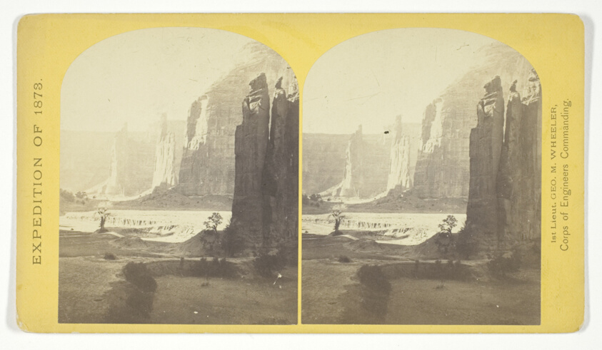
Central portion of Canñon de Chelle, New Mexico. This Canñon is one of the most remarkable in the west, and is noted for its beauty. The walls are of Red Sand-stone, nearly perpendicular, and at this point are 1.200 feet in height, No. 24 from the series "Geographical Explorations and Surveys West of the 100th Meridian"
Art Institute of Chicago

Lost Lakes, head of Conejos Canon, Colorado, in the Sierra San Juan range, near divide between Conejos and south fork of Alamosa
Getty Museum
Beaver Lake, Conejos Cañon, Colorado, 9.000 feet above sea-level, and 30 miles from mouth of Cañon, No. 35 from the series "Geographical Explorations and Surveys West of the 100th Meridian"
Art Institute of Chicago

Dry Soda Lake, Carrizo Plain, California
Getty Museum
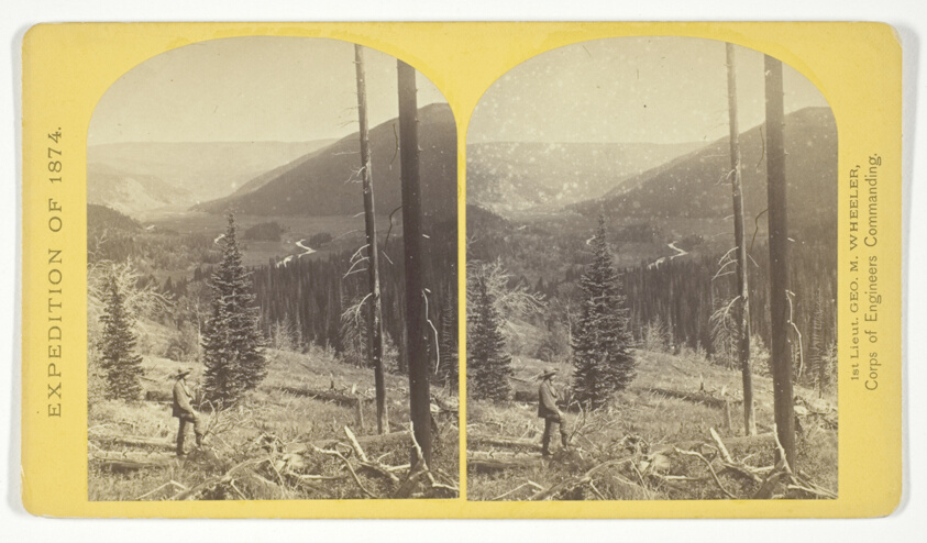
Cañon, Valley of the Conejos River, looking south from vicinity of "Lost Lakes", No. 36 from the series "Geographical Explorations and Surveys West of the 100th Meridian"
Art Institute of Chicago

Pueblo of Laguna, N.M.
Getty Museum