Art Institute of Chicago
Historic Spanish Record of the Conquest, South Side of Inscription Rock, N.M.
Timothy O'Sullivan
- Date
- 1873
- Medium
- Albumen print, from the album "Geographical & Geological Explorations & Surveys West of the 100th Meridian," vol. 1
- Culture
- United States
- Department
- Photography and Media
- Institution
- Art Institute of Chicago
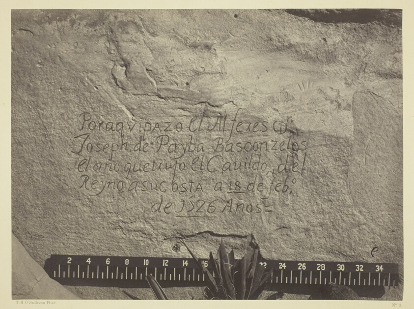
Following the end of the American Civil War, the United States Congress sponsored several major expeditions to chart the western lands, still largely unknown in terms of geography and resources. Such surveys brought together scientists, topographers, and photographers to document their findings. In 1871 Timothy O'Sullivan, who had proven his proficiency in field photography during the war and on an earlier western expedition, was asked by George M. Wheeler to join a government survey of lands west of the 100th Meridian. Survey objectives included achieving a more precise record of the U.S.-Mexico border and studying rocks and plant life, as well as facilitating future commercial development. Factual and blunt, yet sophisticated in composition and often unexpectedly self-referential, O'Sullivan's pictures have intrigued modern viewers. In this image of Inscription Rock in modern New Mexico, which bears the chiseled record of the passage of a Spaniard centuries earlier, he slyly puns on the word "ruler" and suggests perhaps that his own recording equipment can measure and surpass the record of that earlier conquest.
The authoritative record is held by Art Institute of Chicago. LinkedCulture surfaces this object and its connections; it does not alter institutional metadata.
Linked open data
Authority identifiers that link this record into the wider web of cultural data — stable references you can follow to the source.
- Object type
- AAT300046300
Related across collections
Semantically similar works from Art Institute of Chicago and other institutions.
Historic Spanish Record of the Conquest, South Side of Inscription Rock, N.M. Geographical & Geological Explorations & Surveys West of the 100th Meridian. Expedition of 1873. -Lieut. Geo. M. Wheeler, Corps. of Engineers, Commanding.
Art Institute of Chicago
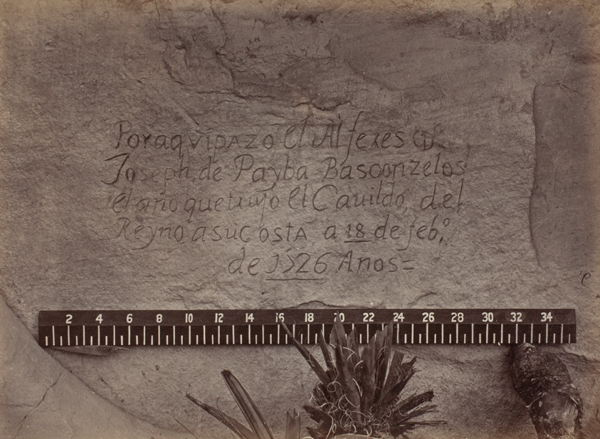
Historic Spanish Record of the Conquest, South Side of Inscription Rock, N.M.- No. 3., from the album "Geographical & Geological Explorations & Surveys West of the 100th Meridian," vol. 1
Art Institute of Chicago
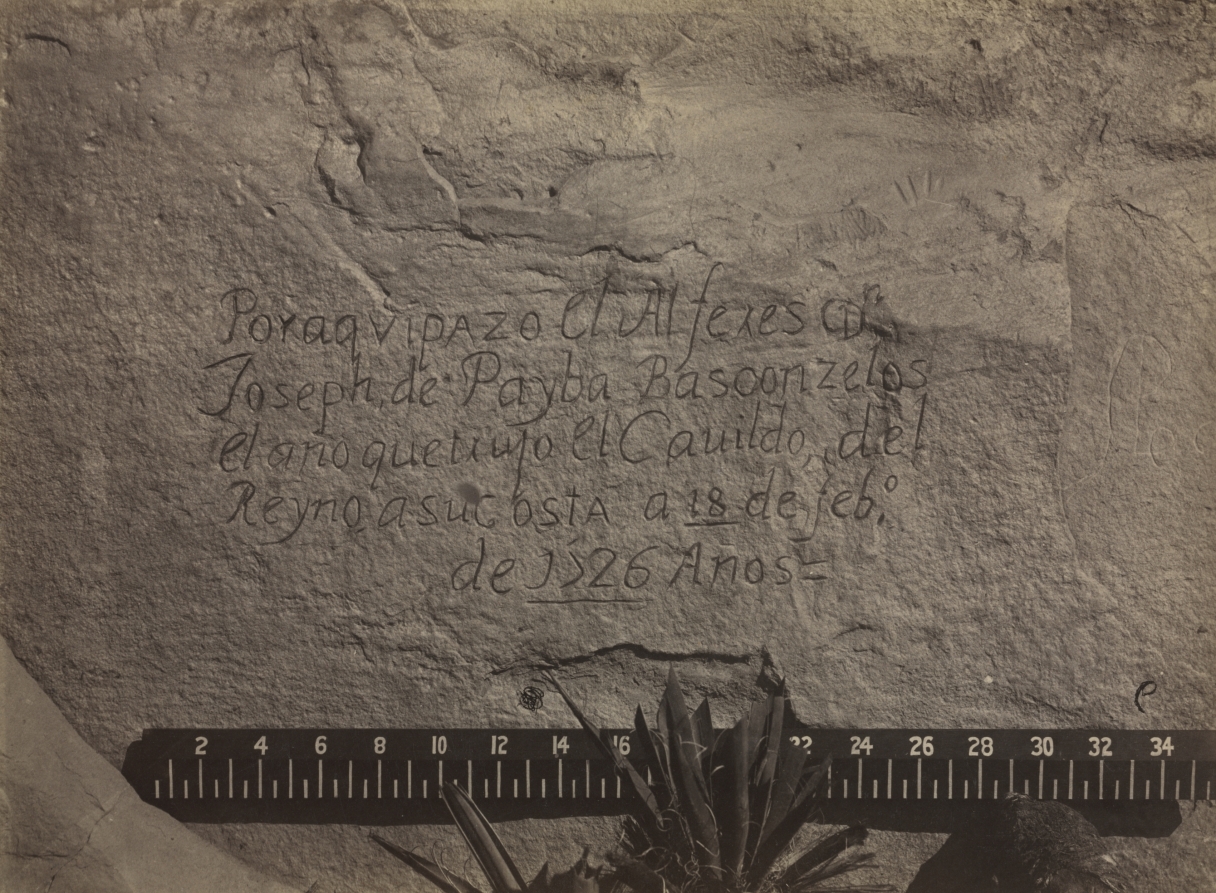
Historic Spanish Record of the Conquest, South Side of Inscription Rock, N.M., No. 3
Cleveland Museum of Art
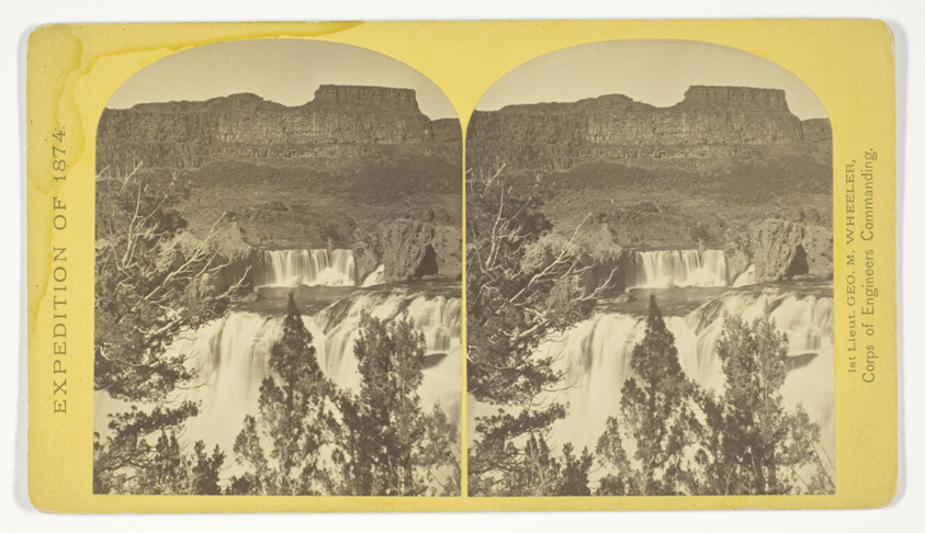
Shoshone Falls, Snake River, Idaho, looking through the timber, and showing the main fall, and upper or "Lace Falls", No. 49 from the series "Geographical Explorations and Surveys West of the 100th Meridian"
Art Institute of Chicago
The South Side of Inscription Rock
Art Institute of Chicago
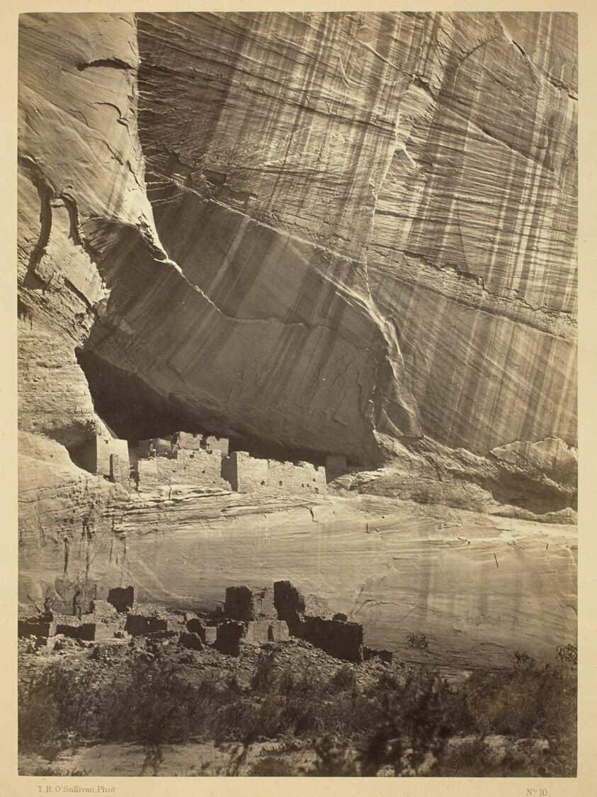
Ancient Ruins in the Cañon de Chelle, N.M. In a niche 50 feet above present Cañon bed.
Art Institute of Chicago
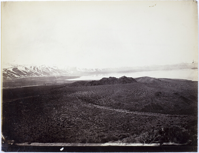
Mono Lake, Volcano, 13,000 Feet
Art Institute of Chicago
Geographical Explorations and Surveys West of the 100th Meridian
Art Institute of Chicago
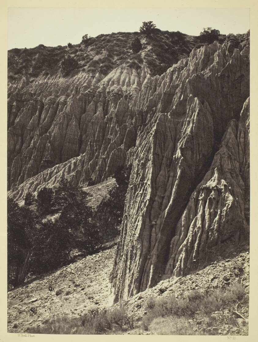
Rain Sculpture, Salt Creek Canon, Utah
Art Institute of Chicago
Cañon, Valley of the Conejos River, looking south from vicinity of "Lost Lakes", No. 36 from the series "Geographical Explorations and Surveys West of the 100th Meridian"
Art Institute of Chicago

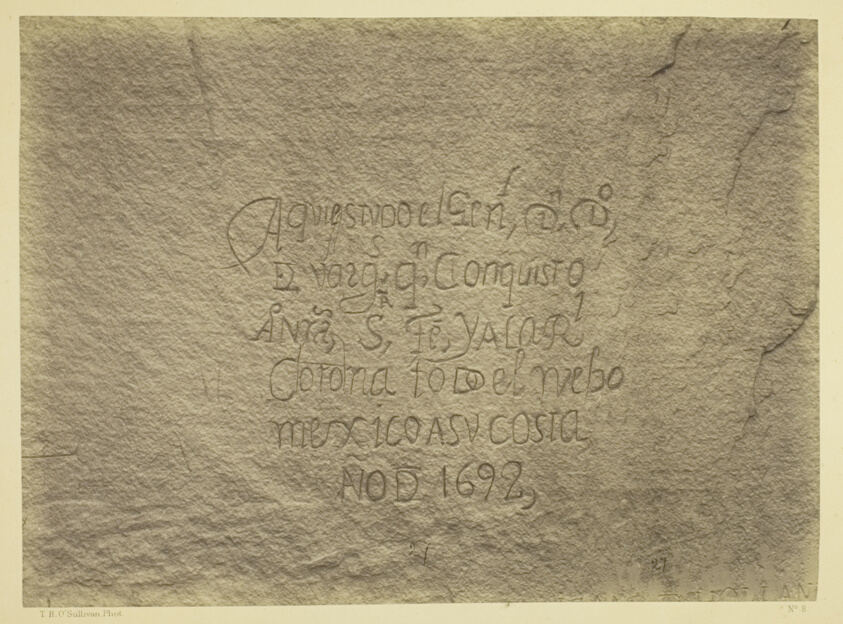
Old Spanish Record, on north wall of Inscription Rock, N.M. The rock is of soft, gray sandstone...
Getty Museum
East Humboldt Mountains, Utah
Cleveland Museum of Art