Art Institute of Chicago
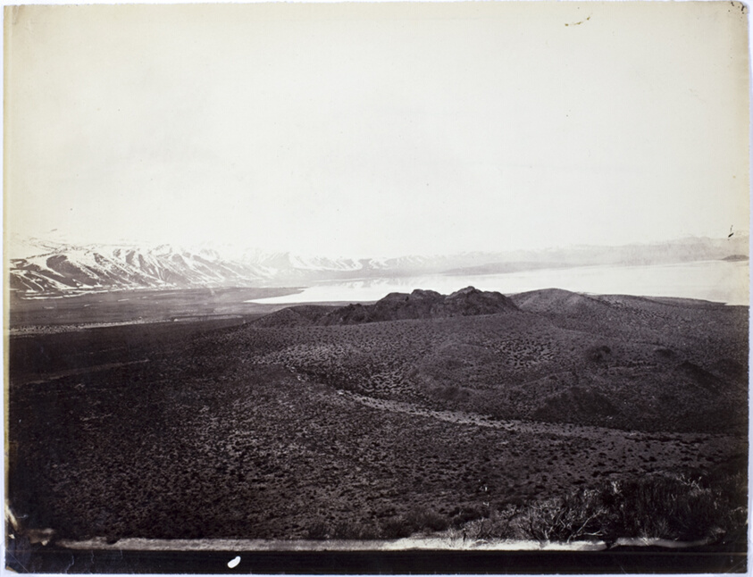
Mono Lake, Volcano, 13,000 Feet
Timothy O'Sullivan
- Date
- 1868
- Medium
- Albumen print
- Culture
- United States
- Department
- Photography and Media
- Institution
- Art Institute of Chicago
Timothy O’Sullivan is acclaimed for landscape photographs of the American West that are bleak and subtle, seemingly more in step with a modernist aesthetic than with the period in which they were made. After establishing his reputation documenting the Civil War under Mathew Brady and Alexander Gardner, O’Sullivan served as official photographer for the Geological Exploration of the Fortieth Parallel, under geologist Clarence King. Covering a 200-mile swath of land along the path of the coming transcontinental railroad, from the California-Nevada border to Cheyenne, Wyoming, the survey had scientific objectives but was also followed closely by the interests behind the railroad and those who sought to profit from the region’s mineral resources. The pictures O’Sullivan produced on the King’s survey contrast with the majestic western landscapes made by his contemporaries; he often emphasized the desolate emptiness of expanses of land, as in this image of the shallow, saline Mono Lake.
The authoritative record is held by Art Institute of Chicago. LinkedCulture surfaces this object and its connections; it does not alter institutional metadata.
Linked open data
Authority identifiers that link this record into the wider web of cultural data — stable references you can follow to the source.
- Object type
- AAT300046300
Related across collections
Semantically similar works from Art Institute of Chicago and other institutions.
East Humboldt Mountains, Utah
Cleveland Museum of Art
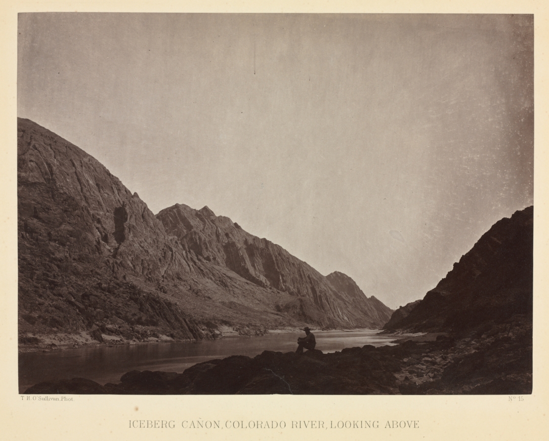
Iceberg Canyon, Colorado River Looking Above
Cleveland Museum of Art
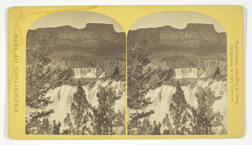
Shoshone Falls, Snake River, Idaho, looking through the timber, and showing the main fall, and upper or "Lace Falls", No. 49 from the series "Geographical Explorations and Surveys West of the 100th Meridian"
Art Institute of Chicago

Black Canyon, Colorado River, Looking Above from Mirror Bar
Minneapolis Institute of Art
Alpine lakes, and mountain scenery, in the Cerro Blanco Mountains, Colorado, 13.000 feet above sea-level, No. 47 from the series "Geographical Explorations and Surveys West of the 100th Meridian"
Art Institute of Chicago
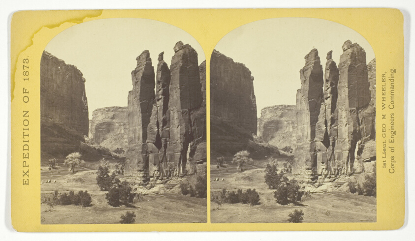
Camp Beauty, Canñon de Chelle; walls 1.200 feet high, width of Cañon at this point about one fourth of a mile. This view shows the perpendicular effect wrought by the action of floods. The Artist of the Expedition, Mr. Wyant, of New York, made a study of this scene with the intention to paint it as a characteristic Canon view, No. 25 from the series "Geographical Explorations and Surveys West of the 100th Meridian"
Art Institute of Chicago
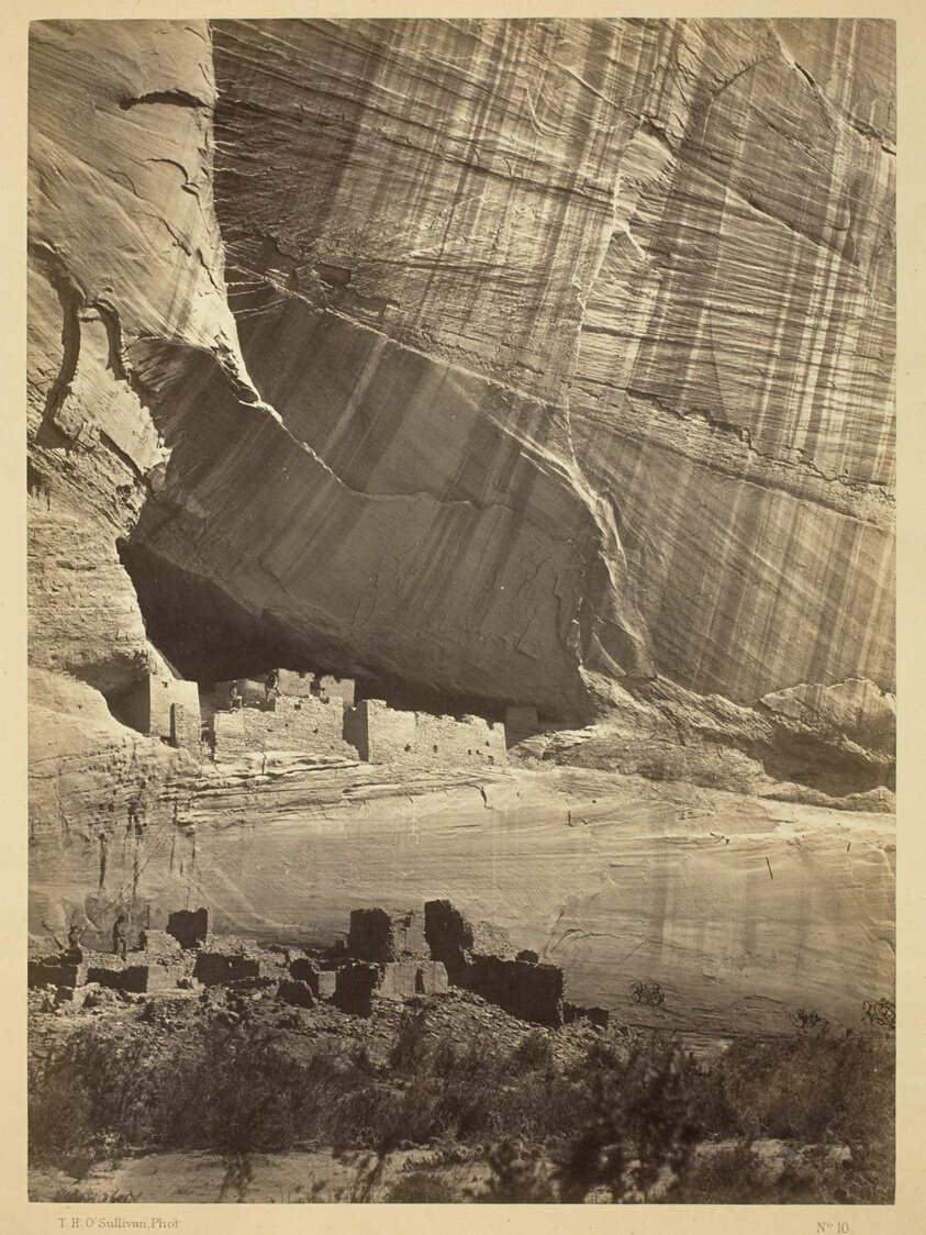
Ancient Ruins in the Cañon de Chelle, N.M. In a niche 50 feet above present Cañon bed.
Art Institute of Chicago
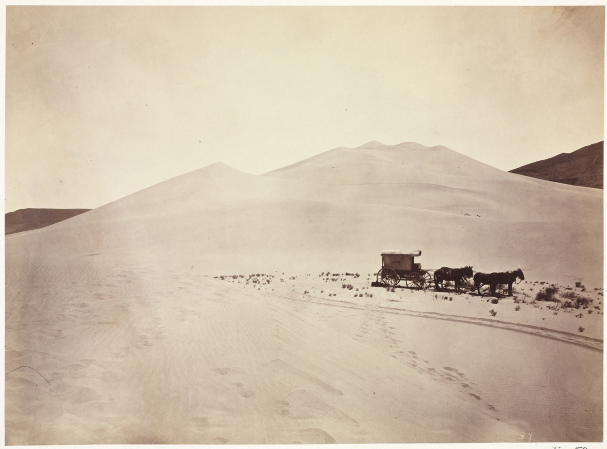
Sand Dunes, Carson Desert, Nevada
Cleveland Museum of Art
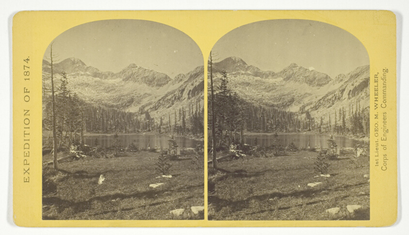
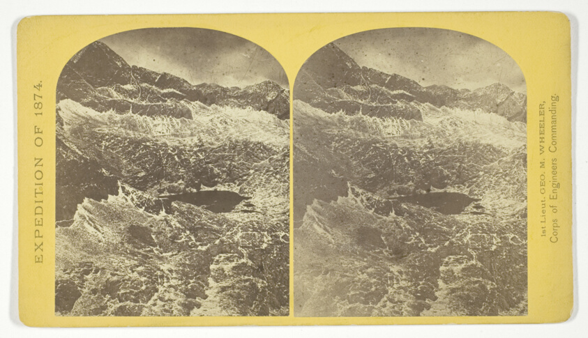
Alpine Lake, in the Cerro Blanco Mountains, Colorado. One of a group of ten lakes at the main head of Ute Creek. 11.000 feet above sea-level. Cerro Blanco Peak rises 14.269 feet abov the sea, lying to the westward, No. 45 from the series "Geographical Explorations and Surveys West of the 100th Meridian"
Art Institute of Chicago
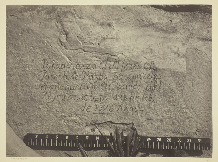
Historic Spanish Record of the Conquest, South Side of Inscription Rock, N.M.
Art Institute of Chicago
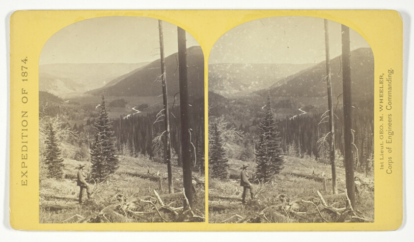
Cañon, Valley of the Conejos River, looking south from vicinity of "Lost Lakes", No. 36 from the series "Geographical Explorations and Surveys West of the 100th Meridian"
Art Institute of Chicago
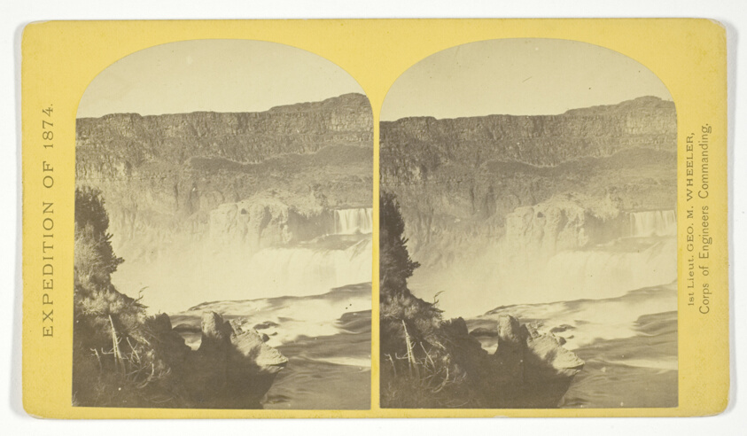
Shoshone Falls, Snake River, Idaho, Main Fall, 210 feet from upper to lower level, width of fall, 800 feet from upper to lower level; Height of Cañon wall at the falls, 1.000 feet. A number of minor falls, Islands, and boulder rocks above the main fall add beauty to the lonely majesty of this scene, No. 48 from the series "Geographical Explorations and Surveys West of the 100th Meridian"
Art Institute of Chicago